Trenches FI and FII
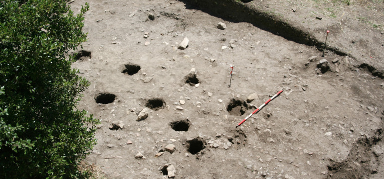
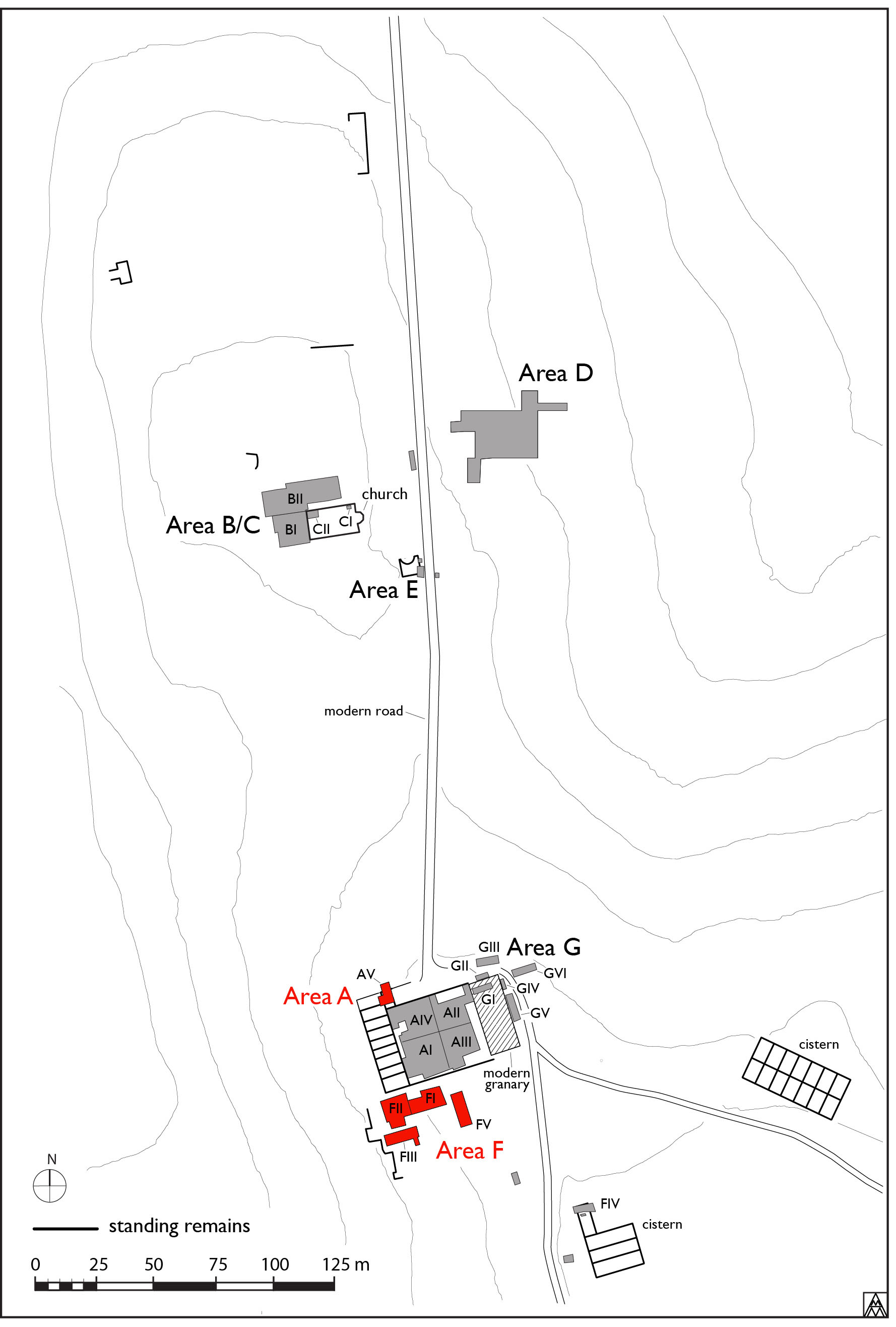
These areas were opened in 2008 to investigate the southern continuation of the monumental staircase uncovered north of the casale wall, as well as a round structure at the corner of the casale (Fig. 1). The first season of excavation revealed numerous modern interventions, including terrace walls, postholes for garden pergolas and flower beds from the early 20th century. We also very quickly unearthed Roman remains: two standing but damaged Roman opus reticulatum walls oriented north–south, which we interpreted as the continuation of the aforementioned staircase, and the round structure to the west, interpreted as a hot room of a bath complex. At the end of the first season, we came down on a surface cut by numerous post holes recognized as medieval because of the associated pottery. In 2009, we concentrated most of our effort to the west of the Roman walls, in Trench FI an area measuring 7.5 m (E–W) x 6 m (N–S), to further understand the sequence of human activity. In the final season of excavation (2010), in the interest of time, this area was further limited to the extreme western third of this trench, measuring approximately 3 m (E–W) x 6 m (N–S). Cumulatively, this excavation brought to light a series of medieval huts spanning more than three centuries of occupation, which will be discussed below. We aimed to understand the chronology of the medieval reoccupation of the villa complex and to reach the floor surface of the baths in this area, as had been achieved in FII. The eastern area (FI) was excavated by Darian MarieTotten, with Roberta Ferritto, Ismini Miliaresis, and Federica Pollari, while the western area (FII) was excavated by Dirk Booms, with Kimberley Brown, and Seth Bernard. The field-direction of the area was undertaken by Andrea di Miceli (2008) and Marco Maiuro (2009, 2010).
Post-Roman/medieval period
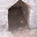
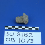
After the abandonment of the atrium of the Roman bath complex, a cut 8183 was made to rob out the fistula running under the opus signinum surface 8176 (Fig. 2). We can conjecture that the mosaic floor 8177 was probably still in place, as the fill of this cut, (8182), had a medium concentration of mosaic tesserae in it. The removal of this pipe was nearly total, except for the small lead valve (Fig. 3) also discovered in this fill. Unfortunately, no pottery was found to date the deposit.
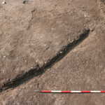
Subsequent to the abandonment of this structure and after the mosaic pavement had degraded, layer (8175) was deposited on top of the opus signinum surface. This layer, (8175)=(6253), was a dark, nearly black, friable sandy clay soil with traces of burning and heavy charcoal inclusions, between 12 and 25 cm thick (Fig. 4). It yielded the most pottery and animal bone of any other context excavated in 2010. Building rubble (cubilia, broken brick and mortar chunks) was distributed throughout the stratum, but with a notable concentration along the northern, southern and western edges, corresponding to the positions of the Roman walls. Forum Ware pottery was also found in moderate concentration in this deposit. Due to the traces of burning, the presence of some building rubble, and pottery and animal bones, this stratum can be interpreted as relating to a reoccupation in the area dating to the early ninth century. The deposit covered the remains of the Roman atrium and stylobate of the bath complex, a total excavated area of approximately 8 m (E–W) x 7 m (N–S) across trenches FI and FII.
This reoccupation deposit was then followed by a period of scant human activity and the definitive collapse of the Roman structures around it. Deposit (8169)=(6214) covered the full extent of the trench from north to south sloping to the south. For this reason, it seems to relate to the collapse of a wall located to the north of the trench, perhaps the south wall of the hot range. This is interpreted as the earliest phase of collapse: a cut, 8174, filled with a very black soil (8173), rich in charcoal inclusions, was the first sign of human activity noted after (8169) was deposited. There were no ceramics found in this fill, but three large cow bones were deposited there and perhaps simply represent the burial of occupation debris from nearby.
A deposit of soil with a medium concentration of building rubble inclusions, (8172), formed on top of (8169). A dark brown sandy clay layer (8171) covered the deposit of soil, (8172), distinct for its color. These layers contain little evidence of human activity—(8171) had a few sherds of pottery and (8172) had just one, a piece of Forum Ware dating to the early ninth century. There were very few animal bones, and both displayed heavy concentrations of rubble. After these accumulations, there are successive horizons with evidence of habitation (Fig. 5).
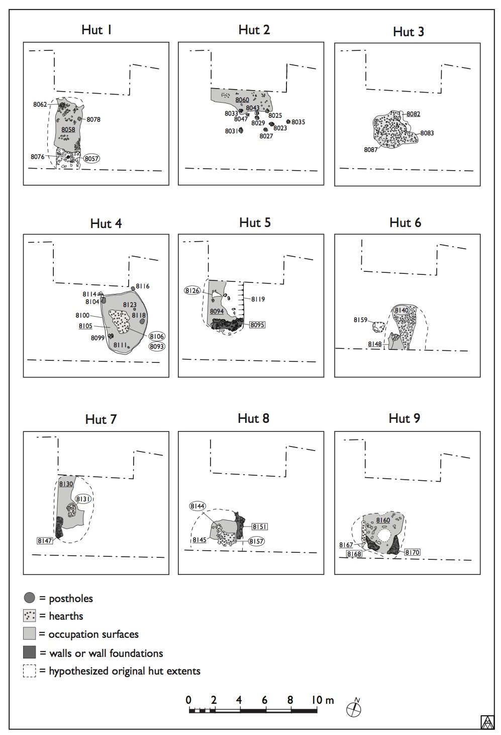
The first identifiable structure in the sequence, Hut 9, was constructed on top of (8171). The hut is recognizable by its floor surface, hearth and earthen wall foundations (Fig. 6). An area of compact clay with a multicolored burned surface, (8167), interpreted as a hearth, is located on the western edge of this structure. Traces of earthen mortar wall foundations to support wattle and daub construction [8168] and [8170] surround a clayey beaten-earth surface 8160. The hut had an elongated oval form, as far as could be discerned. As no clear cut to delimit this structure was identified, it was more probably constructed directly on top of the debris of (8171). The wall foundations were constructed on this same debris and were partly smeared on their interior by the same yellow clay soil used to make the floor surface. Since we do not know the full extent of this hut structure, we also cannot say with certainty whether the hearth was placed centrally or not. This structure was disturbed by later intervention in the modern period, with the construction of the terrace wall [8181], leaving us with only part of its overall extent.
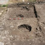
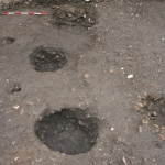
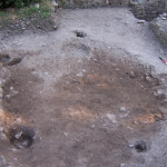
After the abandonment of this hut, a brown sandy-clay layer, (8166), accumulated. Into this deposit two large circular pits some 50–60 cm deep were cut, 8155/(8154) and 8165/(8164) (Fig. 7). Their similar size and depth offer clues to their function, possibly as silos for food storage. No domestic structures connected to these features were found; they were likely related to a habitation beyond the trench limits.
In a subsequent moment, the pits 8155 and 8165 were filled with dark soils, with high concentrations of building rubble. Fills (8154) and (8164) were unremarkable as deposits, containing very little pottery and/or animal bone. It seems that these cuts were deliberately filled in order to level the terrain for the construction of later habitation. After this leveling activity, we encountered the remains of intensive and near continuous occupation in this area. There were eight distinct hut structures found, with two short periods of abandonment.
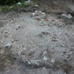
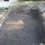
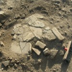
Hut 8 was small, as far as we can tell. The lowest surface related to this hut structure, 8157, demonstrated considerable traces of burning, as well as a large, amorphous stain of burned clay. It rested in part on the beaten earth surface of Hut 9 that preceded it. This was probably a first phase of Hut 8’s hearth, dismantled when the hut was repaved and a new hearth (see below) was constructed. Surface 8157 was covered by 8145, a compact clay surface of a yellow-brown color interpreted as the beaten earth floor of Hut 8 (Fig. 8). In this surface, two quern pieces, both complete, were embedded. These querns were of similar diameter, but not thickness. Upon excavation of this stratum, it was realized that the western quern rested on a perfectly cut piece of reused Roman opus signinum. Toward the end of the season, as the trench was extended 10 cm to the south, a third quern at the level of this hut was visible in section. The remains of a hearth (8144), were delineated to the south by a large flat irregularly-shaped fragment of opus signinum and some stones along the eastern edge. These were smeared with clay, probably during the construction of this hearth, which itself had reddened. The burning at hearth (8144) was extensive, there was ash in abundant quantities and the degraded terracotta of its tile surface was cooked to brilliant orange and yellow hues. The eastern limit of this hut was delineated by the rudimentary foundation of a wall, [8151], the elevation of which was probably constructed with wattle and daub or other perishable material. A post-hole, 8133, seems to mark its extent to the north, while another 8153 is indicative of a post at the interior of the structure. The presence of the querns along the southern edge of the trench, and hearth (8144) located at the western limit makes it entirely possible that, like Hut 9, this structure was larger than it appears to us. We cannot know for sure as the cut for terrace wall [8181] destroyed all remains to the west, while the area to the south passed beyond the limit of excavation.
Immediately to the north of Hut 8, a later structure, Hut 7, was uncovered. We are certain this structure post-dates Hut 8 because its earthen wall [8147] in part covered an earlier hearth (8144). In addition, the yellowish brown mortar that covered layer 8130, into which its hearth was cut, also covered the occupation surface of Hut 8 at its northern edge. The most convincing feature of this hut was its hearth (8131), made of broken tile and brick fragments laid flat on 8130 and arranged in what appears to have been a triangle (Fig. 9). The northernmost corner of this hearth was also damaged by the later cut. That this hearth rests on 8130 makes a good case that this mortary stratum was the floor of the hut. The remains of this hut were quite fragmentary, as a later cut (8119, discussed below) damaged certain features.
To the east of Hut 8, we uncovered another structure with a hearth. Hut 6 was small and not easily defined due to its poor preservation. It also likely continued beyond the limit of excavation to the south, leaving its southern portion uninvestigated. This hut was constructed over a foundation composed of a sandy dark brown soil with inclusions of stones, broken bricks and mortar chunks, (8148), that in part covered the floor surface of the earlier Hut 8 to the west. What remained was oval in form. A hearth (8140) extended south into the trench edge (Fig. 10). Mortar chunks and stones were arranged in a circular pattern outlining this hearth. Again, these were smeared with clay then reddened by heat. A cut into the remains of Hut 8, 8159/(8158) might have served as a midden for either Hut 7 or Hut 6. A second midden was found cut into the foundation of Hut 6 8143/(8142) (and disturbed by a still later cut 8139 discussed below). Due to its stratigraphic position, it post-dates Hut 6, possibly serving as a midden for a later hut. The cut for a later hut, 8100, disturbed the eastern side of Hut 6.
Once these huts fell out of use, occupation appears to have ceased in this particular part of the village. Huts 6, 7, and 8 were all covered by a friable greenish-grey silty sand, (8127), which we have interpreted as an abandonment stratum. This stratum was later cut by 8139, whose fill (8138) of concentrated ceramic sherds and animal bone identifies it as a midden. No structure contemporary to this midden has been identified in the trench, but might have belonged to a habitation a few meters to the south. After the use of this midden, there appears to have been a further period of abandonment/collapse, when a yellowish-brown sandy silt stratum (8122) formed. This deposit had large inclusions of mortar and brick rubble along with white stones in medium concentration. This stratum was heavily disturbed by the construction cuts for later Huts 5 and 4. Only a small strip of soil remained running north-south at the center of the trench.
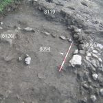
These two cuts were related to two different sunken structures. The first cut, 8119, was nearly linear, extending north–south for half the width of the trench, and creating a baulk about 50 cm tall. It was filled by two distinct features that together formed Hut 5 (Fig. 11). The first was an earth masonry wall [8095] made of brick fragments, irregular tufa chunks and roughly hewn stones (all materials appeared reused). It did not have regular courses, but did have a recognizable rectangular form with a slight curve on the eastern edge. It did not extend beyond the limit of cut 8119. This wall rested in part on the mortary stratum (8130), which the linear cut also disturbed. The floor surface of this structure, 8094, was made of beaten earth, reddish brown in color and quite smooth. On top of this surface a triangular-shaped clay mound (8126) was built. It contained an unusually high concentration of pottery. Its function is at present unclear and lacked any traces of burning, although its use as a hearth is one possibility. Also found resting on this surface was a single linear alignment of broken bricks and stones whose function is obscure. It is quite possible that the continuation of this structure to the West was destroyed by modern interventions, where a hearth marked by actual use might have been placed. Eventually this structure fell out of use, and an earthen deposit (8086) with a high concentration of animal bones accumulated. The bones might indicate its possible use as a midden in a later phase.
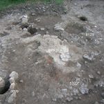
The second cut, 8100, was also made into (8122) at the west and (8125) at the east. It formed an elliptical building, Hut 4 (Fig. 12). The cut was not of a consistent depth, but instead was shallower to the north, as the terrain there was sloped. At its deepest, the cut was ~20 cm deep. It is identified as a habitation structure 4.7 meters in length and 3.5 m in width. After the foundation trench had been cut, a beaten earth floor surface 8105 was laid inside (Fig. 13). This had some sparse mortar fragment inclusions, brick fragments and small stones, but for the most part was a smooth surface, with a slight N–S slope.
The post holes associated with this structure were also cut into this layer, indicating that this fill was deposited before the superstructure was constructed. While there is some variation in size, three of the postholes would be considered large (between ~30–40 cm in diameter) and sub-circular in form, 8099/(8098), 8104/(8103), 8118/(8117). These three were considerably deep (~30 cm) and all had supports for wedging the post framing the edges into place: brick, tufa and roughly hewn stone fragments. One smaller post hole to the south east, 8111/(8110) was ~10 cm in diameter, ~10cm deep and lacked wedges, and as was another at the northeast 8123/(8122), similar in its dimensions and appearance. Cut 8109 for a centrally placed hearth was dug into this beaten earth surface at the centre of the structure and a foundation of reused mortar fragments, white stones, tuff and, less prevalent, reused brick fragments [8108] was laid in this cut. This hearth had multiple phases of use and repair, as the layers of burnt terracotta tiles/bricks used to form the cooking surface, (8106) and (8107), have slightly different orientations. An ashy stratum (8093) associated with the final layer of this hearth (8092) also covered surface 8105 (Fig. 14). By its final phase, this hearth had created a small mound on the floor surface, remnants not discernible with other hearths excavated in this trench. The abandonment of Hut 4 saw the accumulation of a brownish-gray silty-sand layer (8097) that covered the eastern portion of the trench.
On top of this abandonment layer, surface 8084 was laid, composed primarily of fragments of broken pottery and small mortar fragments and a compact soil matrix. This pavement was very fragmentary, but popped up in many places throughout the trench. It is believed to have covered most of this area, and had a direct relationship with a hearth structure (8083) found at the center of the trench (Fig. 15). Although no post holes were found to delineate a structure, the presence of this hearth and pavement suggests that there was a domestic structure there, designated as Hut 3. The surface of this hearth, made of brick fragments and stones, was fragmentary and displayed clear traces of burning. It was built on a sub-circular stratum of burnt clay (8089) which in turn covered a layer of dark earth mixed with stone and brick fragment inclusions (8088). These stones seem to have formed a foundation for this hearth over which the clay layer was spread and then the brick/stone surface. Immediately beside this hearth, a large road paver was found, possibly serving as a food preparation surface. An oval cut 8087 next to the hearth was filled primarily with ash and animal bones, the remains of food preparation. To the west of the hearth was found a stratum of a dark brownish black soil with large stone and tufa inclusions (8090). This stratum most likely formed part of a preparation for what was placed above, and is very similar to the preparation found under the hearth. A stratum of black, ashy soil 8082 was found immediately surrounding the hearth, overlaying the pavement in part. This stratum yielded the most convincing domestic finds from this hut: two iron fragments, one in the form of a blade; and two weaving implements, a terracotta spindle whorl and a lead loom weight.
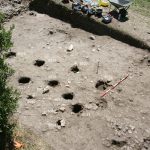
Hut 3 was covered by 8041, a smooth stratum which was marked by increasingly concentrated inclusions limestone, tufa and broken brick in its lower portion. These inclusions were probably a leveling for the creation of the smooth surface. The soil matrix was a silty-clay, brownish-yellow in color. In this stratum, multiple post holes in were dug in a generally circular pattern defining Hut 2 (Fig. 16). The earliest phase of Hut 2 was defined by a smaller semi-circle of post-holes, 8045/(8046), 8049/(8050), and 8064/(8065). At a certain point, these holes were covered by a pavement, 8004=8060, made of pottery and broken tile sherds in a soil matrix. The second stage of postholes—8023/(8024), 8025/(8026), 8027/(8028), 8029/(8030), 8031/(8032), 8033/(8034), 8035/(8036), 8037/(8038), 8043/(8044), and 8047/(8048)—then seems to have expanded the size of the structure, although it is possible that some were reused from the first phase. This could not be discerned stratigraphically. The postholes were all characterized by the presence of brick, tufa and limestone wedges serving as post supports, similar in technique to those found in Hut 4. When the fills of these holes were excavated, they were discovered to be quite deep and with diameters upwards of ~35–40 cm. The orientation of these post holes suggests that this hut used the standing Roman wall to the north as part of the structure in its multiple phases. Unfortunately, the presence of a large cypress prevents full exploration of the relation between the wall and the hut. No hearth was discovered in this structure.
The most recent hut found in this trench, Hut 1, was cut into 8041 and 8004=8060, disturbing an earlier structure. This cut was filled with two deposits—one (8057) characterized by stones, and the other (8059) a dark brown soil—to create a foundation. Three small postholes, 8062/(8063), 8076/(8077) and 8078/(8079) were found associated with this hut, cut into the foundation fill. Over this fill, a compact beaten earth surface 8058 was created (Fig. 17). Later interventions, mostly in the modern period, destroyed the western extent of this structure and keep us from fully comprehending its form.
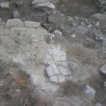
At the far western end of the trench, in an area limitedly investigated in 2009, the remains of a wall [8007] running N–S, were excavated (Fig. 18). This wall was constructed of reused fragments of tuff, mortar, broken tiles and also the local white stone, probably using a dry masonry technique. Although a tentative hypothesis, this wall might have delineated the boundary of the village at a point in time (for the remains of another wall, also running N–S to the immediate W of this feature, see below). This wall was not likely defensive in nature due to its thickness and the quality of construction. If not used to define the edges of the village settlement, it is possible that it was part of a delimited area to contain animals.
Modern period
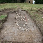
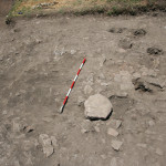
The interventions from the modern period include five large circular cuts—8017/(8018), 8019/(8020), 8035/(8036), 6239/(6240), 6244/(6245)—following the alignment of the modern casale wall to the north that were interpreted as the remains of a garden pergola dating to the early twentieth century, and remembered by elderly neighbors (Fig. 19). This garden also had rectangular flowerbeds: we found the remains of two that were outlined with modern tiles. The slope of the terrain here created a succession of modern wash layers which covered the remains of this garden pergola, (8015), (8006) and (8000). In a later phase, terrace walls [8001] and [8002] were constructed in dry earth masonry using rectangular white limestone and oriented north–south, directly in line with the Roman walls [8011] and [8013] situated below (Fig. 20). A third terrace wall [8080] was trench-built deep in the soil and had a similar construction and orientation. This wall was located at the westernmost limit of trench FI. This garden structure destroyed in part the later structures of the medieval settlement to the west of it in Trench FII.
Trench FIII
Immediately to the south of trench FII and southeast of trench FI further evidence of medieval occupation at the site was uncovered. In the Roman period, walls of both opus reticulatum and opus latericium formed three distinct rooms, two of which were investigated in depth by Raffaele Laino and Andrea di Miceli in the 2009 season. These spaces were interpreted as storerooms associated with the adjacent bath complex found at their north. The abandonment of these rooms in the post-Roman period was followed by the collapse of the roof in the western room, as can be tentatively reconstructed from the stratigraphy and dating elements. This was utilized as a dump for construction waste deposited in two phases, layers (7512) and (7515). In the medieval period, the central room was modified by closing off access to this western room through the construction of a wall against the accumulated earth and debris. A beaten earth surface 7526 then followed; it had inclusions of animal bone and cooking wares, especially their lids or covers. The surface lacked the main markers of a habitation (a hearth and post holes) though there were charcoal inclusions throughout. This layer was covered by 7525, a light brown silty layer also with inclusions of animal bone, cooking ceramics, and more charcoal. This layer was also cut by 7523, roughly triangular in form, which was later filled by a stratum of earth and stones (7524), whose exact function is difficult to interpret. The room was definitively abandoned in the medieval period with the deposition of layer (7519), which lacks ceramics or other evidence of human activity. (Fig. 21)
Trench FV
This trench, excavated by Paola Umbri and Marco Bianchi, offered further evidence of medieval settlement in the area south of the casale. Located to the east of the Roman corridor, the medieval remains found here were located under a thin layer of grass and humus, and were disturbed in places by the installation of metal piping related to the modern casale. Much of the trench was occupied by the top of the vault [10119] of the Roman corridor which ran north–south, parallel to the main imperial corridor. Postholes in the vault of this corridor indicate the presence of huts here as well. To the east of the flat surface of the vault, a beaten earth surface 10118 was revealed, clearly the latest medieval stratigraphy present in the trench (Fig. 22). This covered a space delimited to the north by a stone wall [10106] running east–west, and represented by a single course of stones, roughly faced. Against it, to the south, a beaten earth surface 10107 with inclusions of tile, mortar, and ceramic fragments was found. A few postholes to the south of this wall—10103, 10105, 10109, 10111—did not form a coherent pattern. The structure seems to have used the spaces of the vault as a dump, as a sloping cut 10117 next to a window suggests.
A short stretch of a stone wall oriented N–S was uncovered in the East of this trench. This wall was also evident in the 2007 magnetometry survey, and appears to run for at least 40 meters from the casale to the south (Fig. 23). This has been provisionally interpreted as the eastern wall that delimited the entire medieval settlement, although at present it is impossible to know when the wall was built or its direct relationship to the huts or wall [8007], both immediately to its west.
Trench AV
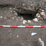
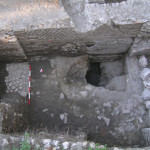
North of the casale in a trench excavated by Candace Rice and Raffaele Laino to investigate the northern wall of the cella vinaria and an associated barrel-vaulted corridor running alongside it, remains of early medieval reuse were uncovered. This vaulted space was part of a corridor running E–W along the north wall of the building, characterized by a cappuccina drain at its base. From this corridor a series of vaults ran N–S. The vaults preserved no trace of a Roman pavement, which was cut away at some point in the post-Roman period. Instead, there was a beaten earth surface 7440 made of a gritty greenish-grey clay with concentrated mortar inclusions. Immediately above this surface were laid two distinct phases of tile paving: 7429 preceded 7430, as the latter in part covered the former at its western end. Paving 7430 was probably the repair of the earlier paved tile surface 7429. A deep semi-circular cut 7439 ran in front of the cappuccina, lowering the floor level in front of this opening (Fig. 24). Over this partially destroyed tile surface and spilling into the cut, a layer of multi-coloured soil and ash, (7444), was deposited, indicating numerous events of intensive and repetitive burning. This layer sloped gently to the south and terminated at a line formed by a few stones, possibly the remains of a small structure constructed to contain a fire. Within the cappuccina conduit, further traces of burning and ash associated with (7444) were uncovered once the stones blocking the cappuccina opening were removed (Fig. 25). The lowering of the floor in front of the cappuccina, the burning at its interior, the accumulation of ash, and the burning on the interior of the cappuccina opening suggests that this cappuccina was reused to contain a fire, as a good draught would have been provided by its opening at the other side of this wall. One possible interpretation is that it served as an oven for food preparation, and more specifically for baking bread. The conduit was very low in the wall, and cut 7439 was probably made to give access to it. Below and to the west of the conduit, a planar surface of tiles covered by a rough mortar 7432 might have served as a preparation surface for products introduced into the oven. Even if not used specifically for baking bread, the evidence of repetitive burning within the conduit and the concentration of ash outside it does at least demonstrate the presence of a cooking space of some kind. These burn traces were not the result of ceramic firing, as there was not adequate space within the conduit to allow for such production. A large sherd of Forum Ware dates the oven complex to the ninth century. Once this oven went out of use it was blocked with stones and fill (7424) accumulated. This fill included large rocks, bricks and later twelfth- and thirteenth-century medieval pottery. In the later middle ages, this became a space to dump refuse.
![Figure 8. Beaten earth floor <span style="text-decoration: underline;">8145</span> of Hut 8, hearth (8144), and foundation [8151].](http://archaeologydata.brown.edu/villamagna/wp-content/uploads/2016/10/Fig-6_hut-8_8145_8144_8151_8133-150x150.jpg)
![Figure 18. Wall [8007] at the east of trench FI.](http://archaeologydata.brown.edu/villamagna/wp-content/uploads/2014/08/Fig20_VM8007-150x150.jpg)
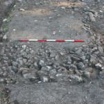
![Figure 20. Modern terrace walls [8001] and [8002].](http://archaeologydata.brown.edu/villamagna/wp-content/uploads/2014/08/Figure-22_VM_8001-e1407171700949-150x150.jpg)
