Record View
Select a record type using the icons below…


Interpretation
-
- destruction of romanesque wall.
-
- Mark Perks
- 23-7-2007
Stratigraphic Relationships
Site Photo
- No records attached.
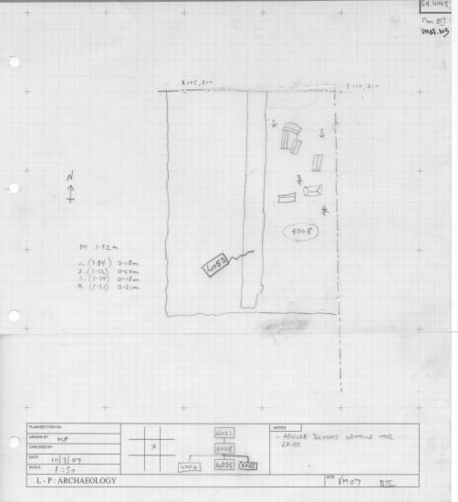
Description
- components
- mattock, trowel
- N-S: 6.60 m; E-W: 2.30 m
- sandy clay
- medium brown
- firm
- good
- artificial
- limestone
- charcoal flecks and chunks
- frequent roof tiles, ashlar stone, mortar patches
- Destruction layer running north to south of B2 from LOE in north to 4006 in the south. Runs along west side of ssu 4053. Contained frequent roof tiles and fallen ashlar stone, some carved to very high standard.
- Contains ashlar stones worked to a high standard. 4048 is compromised by the missed cut 4068 and should be used in conjunction with cut 4068, and fills 4069 and 4070.
- poor
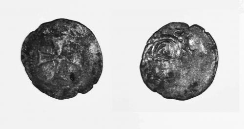
Ceramic Inventory
- 1300 AD - 1350 AD
| Total fragments | |
|---|---|
| 14 | |
| 4 | |
| 10 | |
| 46 | |
| 28 | |
| 1 | |
| 1 |